
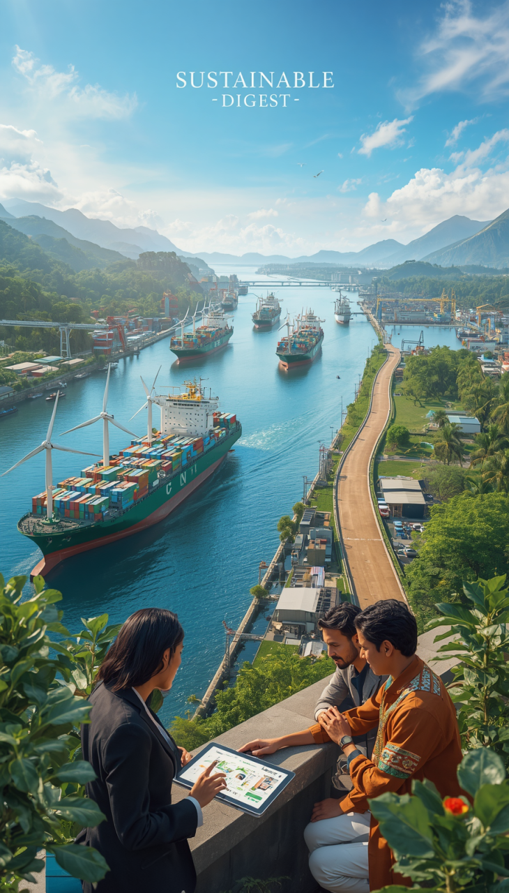
The modern global trade system is a complex, interdependent network whose lifeblood flows through a small set of maritime arteries. According to UNCTAD and IMO data, over 80% of the world’s traded goods move by sea, and a disproportionate share of that volume transits a handful of narrow corridors.
These corridors are logistical bottlenecks that shape the rhythm, cost, and impact of international commerce. A single incident—war, severe weather, or a grounded mega-ship—can cascade into higher freight rates, delayed deliveries, and energy-market volatility.
This article combines history, geopolitics, and engineering to assess how straits and canals influence our economy and supply-chain resilience. We review the strategic profiles and vulnerabilities of key passages and then highlight practical measures for sustainable, robust logistics planning.
Below we examine the Strait of Hormuz, the Suez Canal, the Panama Canal, the Strait of Malacca, and the Bab-el-Mandeb, and explain what recent multilateral actions (OPEC, NATO, EU, AU, ASEAN, UNCTAD and UNECOSOC) mean for supply-chain risk and mitigation.

Straits vs Canals Impact: The Global Trade Chokepoints
Imagine the planet’s commercial flow constrained through a handful of narrow corridors. This is the practical reality of global maritime logistics: a small number of passages determine access between continents and concentrate enormous volumes of cargo.
These features are more than map markers. They act as systemic pressure points in the world economy, affecting freight costs, delivery times, and the resilience of supply chains. A single blockage can cascade into higher insurance premiums, disrupted manufacturing schedules, and energy-market shocks.

What Are Maritime Chokepoints and Why Do They Matter?
A maritime chokepoint is a narrow geographic channel whose limited capacity concentrates and can constrict the flow of shipping. Think of it as a funnel for global trade—when flow slows, the whole system feels the effect.
Blockages do more than delay a vessel; they congest major trade lanes and force rerouting that wastes time and fuel. For example, the Strait of Malacca and adjacent Singapore approaches together carry an estimated share approaching 40% of some measures of Asia–world maritime trade and about one-third of seaborne oil flows (see UNCTAD/IMO data for current figures), illustrating how much traffic can be concentrated in a narrow corridor.
The daily traffic is immense: millions of barrels of crude and millions of containers transit the principal straits. When these corridors are impaired, the consequences ripple across commodity markets and manufacturing supply chains.
The Historical Context: From Ancient Routes to Modern Trade
These corridors have long shaped commerce. Monsoon routes guided dhows centuries ago along corridors that remain central today. Explorers and traders historically risked rounding the Cape of Good Hope to avoid hostile or controlled passages.
Over time, the dominant constraints shifted from wind and current to engineered shortcuts. The Suez Canal, for instance, reduced the Europe–Asia sea distance by roughly 7,000 kilometers, transforming routing economics and accelerating trade growth.
Likewise, the Panama Canal linked the Atlantic and Pacific, connecting some 1,900 ports across about 170 countries (Panama Canal Authority / UNCTAD figures). These canals expanded global trade capacity but also introduced single points of failure requiring active management.
Natural straits and artificial canals both generate strategic dependencies. Whereas ancient traders feared storms and piracy, modern logistics managers must guard against geopolitical brinkmanship, extreme weather, and accidents such as mega-ship groundings—events now measured in billions of dollars per hour of disruption.
The sections that follow profile key pressure points, their specific vulnerabilities, and the contemporary strategies—technical, diplomatic, and operational—that reduce systemic risk in the global supply network.
The Strait of Hormuz: Energy’s Most Sensitive Artery

The Strait of Hormuz is the single most consequential maritime chokepoint for global energy flows. It is the narrow sea outlet for the petroleum-rich states of the Persian Gulf, and any prolonged disruption there has immediate, measurable consequences for oil markets, shipping insurance, and downstream manufacturers.
Because of geography, transit options are limited: tankers leaving Gulf terminals must pass the Hormuz channel to reach open oceans, making the waterway strategically indispensable for seaborne energy trade.
Oil Traffic: 20 Million Barrels a Day and Global Dependence
Throughput figures vary with market conditions and data sources, but leading industry estimates (IEA/OPEC/UNCTAD aggregated) place daily seaborne oil and liquid hydrocarbons transiting the region on the order of tens of millions of barrels per day—commonly cited around 20 million barrels in peak-period assessments, roughly one-fifth of world consumption in those estimates. The strait also channels a significant share of global liquefied natural gas exports.
Navigation is constrained. Formal shipping lanes are narrow—measured in a few kilometers for the main inbound and outbound channels—and the internationally recognized minimum territorial corridor across the approaches is roughly in the order of a few dozen nautical miles, which concentrates traffic and elevates collision and interdiction risk.
Geopolitical Flashpoints: From the Tanker War to Modern Crises
Hormuz has been a recurrent flashpoint. During the 1980s “Tanker War” (Iran–Iraq conflict), commercial shipping became a direct target, prompting escorted transits and wide-area surveillance. More recently, incidents such as tanker seizures, attacks on commercial vessels, and near-misses with naval assets (2019–2023 period) have again highlighted the vulnerability of the corridor and its sensitivity to regional tensions.
Responses historically combine naval presence, diplomatic de-escalation and market measures. NATO and coalition maritime patrols, as well as national escort operations, have been used to reassure trade routes; oil market reactions to tensions are immediate and often visible in futures prices and spot freight rates.
Pipeline Alternatives: The SUMED and Saudi Aramco’s Deterrents
Engineered bypasses provide partial mitigation. Saudi Aramco’s Abqaiq–Yanbu pipeline system can move several million barrels per day to the Red Sea, and Egypt’s SUMED pipeline similarly offers a route that can reduce reliance on the Suez/Hormuz corridor for certain flows. These lines act as strategic “pressure-release valves” but cannot fully substitute maritime capacity or flexibility.
The existence of these pipelines underscores the scale of Hormuz’s role: they reduce but do not eliminate exposure. Maritime shipping remains the most scalable and flexible way to move crude and refined products globally, so the strait’s operational status continues to set a benchmark for global energy security.
What logistics managers should monitor: OPEC production statements and monthly reports (affect supply baselines), IEA market briefs (demand outlook), NATO and regional naval advisories (operational risk), and insurer/broker bulletins (security premiums and routing advisories).
The Suez Canal: The Shortcut That Shaped Centuries
Before 1869, a voyage from Europe to Asia required a long, hazardous journey around Africa. The Suez Canal turned that marathon into a dramatically shorter passage—an engineered corridor that materially reshaped global trade by offering a direct link between the Mediterranean and the Red Sea.
The engineering payoff is concrete: the canal reduces the sea route between much of Europe and Asia by roughly 7,000 kilometers, saving weeks of transit time and millions in fuel costs per voyage. That distance savings translated into a structural change in maritime routes and logistics economics, accelerating the volume and tempo of intercontinental shipping.
Economically, the canal is pivotal. Estimates from UNCTAD and industry monitors commonly place the Suez Canal among corridors handling around 12% of global trade by value—making the waterway a real-time indicator of the health of the international economy and a key artery for container and energy flows.
Engineering Marvel: Reducing Routes by 7,000 Kilometers
By connecting the Mediterranean Sea to the Red Sea, the canal created a continuous east–west maritime corridor that replaced the longer, weather-prone Cape of Good Hope route. The canal’s existence spurred an arms race in naval architecture: shipbuilders increased vessel size to capture per-voyage economies, and the canal authority responded with periodic widening, deepening, and operational innovations to preserve throughput.
Those changes have altered global port and hinterland investment patterns: terminals from Rotterdam to Shanghai and from the U.S. East Coast to ports in the Mediterranean optimized for Suez-transiting vessel classes, while logistics networks adapted to faster, more predictable schedules.
Trade Disruptions: Lessons from the 1967 War and 2021 Blockage
The canal’s strategic value becomes clearest in its absence. The 1967 Arab–Israeli war closed the canal for eight years, forcing oil and cargo shipments around the Cape of Good Hope and prompting the financing of the SUMED pipeline as an emergency overland alternative for crude traffic.
Similarly, the 2021 grounding of the Ever Given—a single large container vessel—blocked the canal for six days and exposed modern supply chains’ fragility. At the peak of the incident, hundreds of ships were queued; industry estimates put the daily value of delayed trade and the knock-on economic costs in the billions. The episode demonstrated that oversized vessel dependence can transform a local accident into a global disruption.
Both the prolonged geopolitical closure of the 1960s and the short, accidental 2021 blockage highlight the same policy point: whether a canal is closed for years or for a day, the systemic ripple effects are profound—impacting freight rates, energy markets (as some oil flows are rerouted), and manufacturing timelines worldwide.
Updated context: recent UNCTAD shipping reviews and Suez Canal Authority operational updates stress continued investments in channel maintenance and digital traffic-management systems. NATO and the EU periodically issue maritime-security assessments that affect insurers’ risk pricing; logistics managers should monitor these releases alongside Suez Authority notices and UNCTAD route analyses.
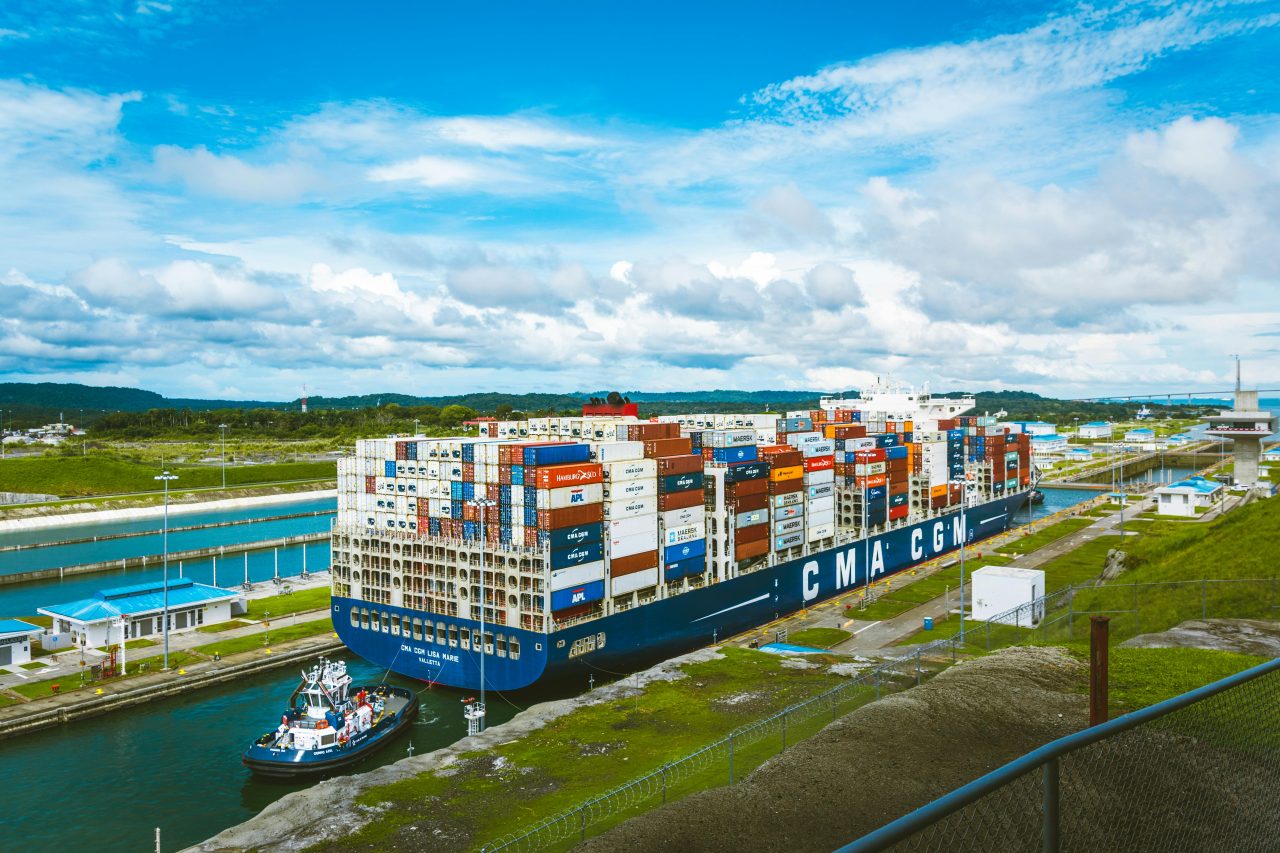
The Panama Canal: From Concept to Global Connector

Carving a shortcut across an isthmus, the Panama Canal redefined distance in maritime trade and became the preeminent artificial chokepoint: a purpose-built waterway that links the Atlantic Ocean and the Pacific Ocean and spares ships the long, hazardous journey around Cape Horn.
The canal turned two oceans into a continuous commercial highway and, in doing so, introduced a predictable cost for distance that global shippers accept because of the time and fuel savings it delivers.
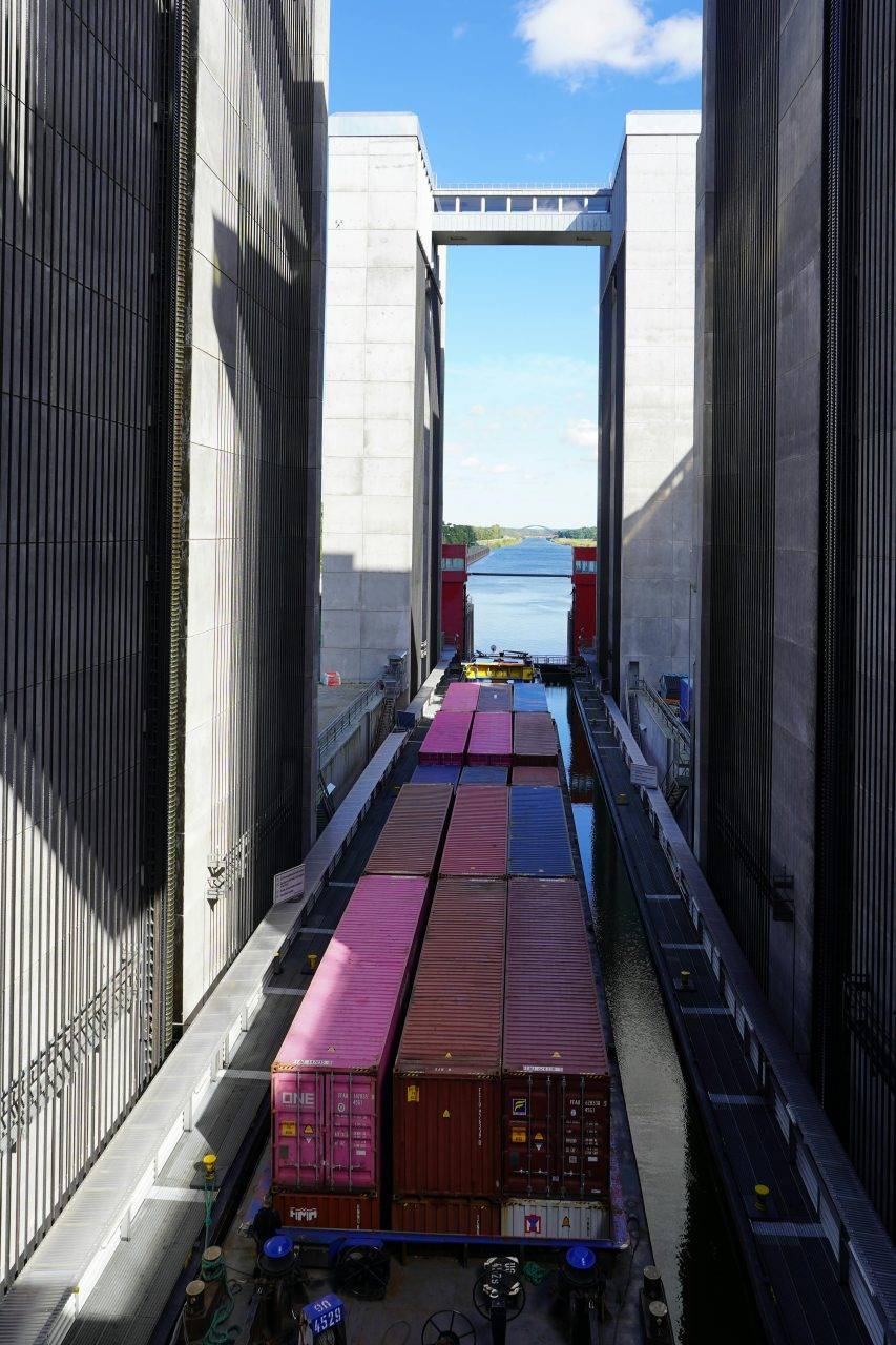
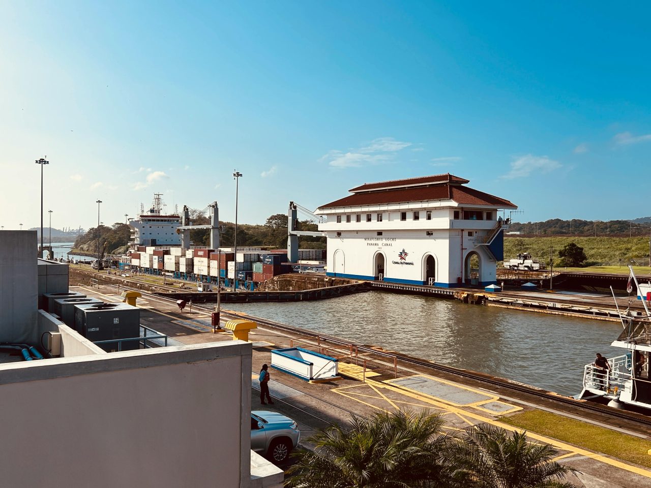
The Expansion Project: Doubling Capacity with New Locks
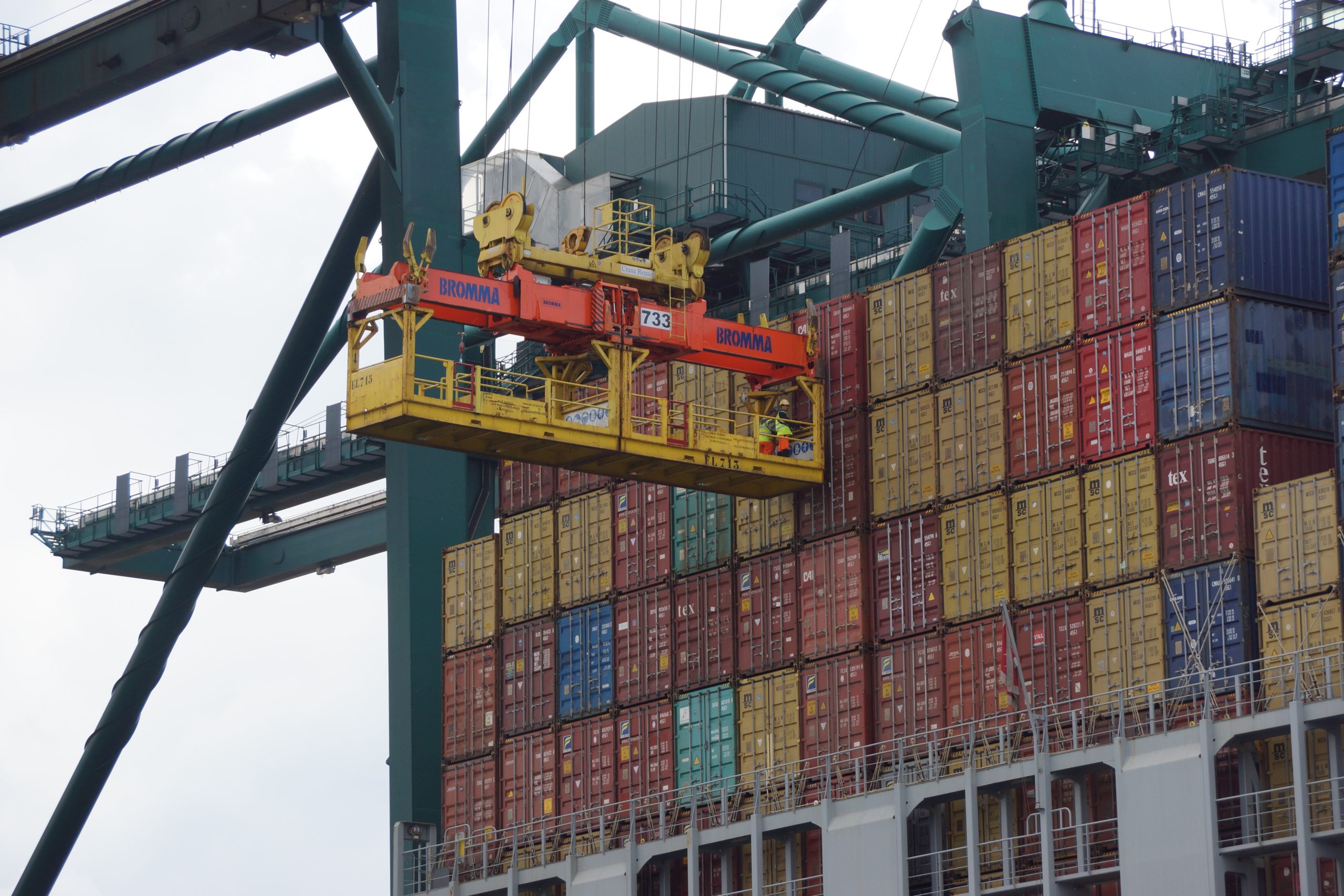
The 2016 expansion addressed a straightforward problem: the original locks could not accommodate the new generation of ultra-large container ships. The new locks measure approximately 427 meters long, 55 meters wide, and 18 meters deep and established the Neopanamax class.
Neopanamax vessels can carry in excess of 12,600 containers—more than double the previous maximum—reshaping port investment decisions from Savannah to Shanghai as terminals upgraded to handle larger ships and greater drafts.
The expansion did more than increase capacity; it forced an entire supply-chain recalibration, as carriers optimized routing and hub calls to capture per-voyage economies while ports and hinterlands invested heavily to sustain the new traffic profile.
Economic Impact: Serving 1,900 Ports in 170 Countries
The canal’s network effect is striking. Official Panama Canal Authority and UNCTAD figures show that the corridor connects around 1,900 ports across roughly 170 countries and supports some 180 distinct maritime routes. Annually, over 14,000 vessels transit the canal, carrying goods valued in the hundreds of billions (often cited near $270 billion in aggregated traffic-value estimates).
This activity represents a meaningful share of global commerce—commonly estimated at roughly 5–6%—and provides a strategic routing option for U.S. East Coast–Asia trade that competes with West Coast gateways and overland alternatives.
However, the canal is not immune to non-accidental constraints. Operations depend on freshwater from Gatun Lake to operate lock gates, and recent climate variability and drought episodes have periodically prompted water-conservation measures that limit draft and throughput—introducing a new, climate-driven mode of potential blockage that differs from ship groundings or geopolitical closures.
That vulnerability reframes the risk calculus: instead of only worrying about collisions or conflict, operators and shippers must now plan around hydrological constraints and seasonal variability as part of route resilience planning.
Logistics managers should monitor Panama Canal Authority notices, UNCTAD shipping reviews, and World Bank/UNESCO climate-vulnerability assessments to anticipate restrictions and rerouting costs. Strategic responses include flexible scheduling, transient load adjustments, and investment in alternate routing capacity where commercially justified.

The Strait of Malacca: Asia’s Economic Lifeline
The Strait of Malacca and the adjacent Singapore approaches form a single, extremely busy corridor—so congested that its traffic density often rivals the world’s busiest urban thoroughfares. This natural channel is the primary connector between the indian ocean and the Pacific, and it remains central to Asia’s export-led growth and global supply chains.
Geography and history combine here: centuries-old spice routes evolved into modern container and energy lanes, concentrating enormous volumes of commerce into a narrow marine funnel that is critical to regional and global prosperity.
Trade Volumes: 40% of Global Trade and One-Third of Seaborne Oil
Estimates from UNCTAD and regional analysts show the Malacca–Singapore complex carries a very large share of Asia–world maritime traffic; some measures attribute nearly 40% of global trade flows between Asia and the rest of the world through this corridor, and it moves about one-third of seaborne oil destined for East Asian markets. These figures underscore how a narrow route can influence global energy and goods supply.
The navigable channel is constrained: at its tightest points the safe transit lanes can be well under two nautical miles wide, forcing mega-container ships and supertankers to navigate with extreme precision and coordinated traffic management.
Strategic Vulnerabilities: Narrow Passages and Security Concerns
The so-called “Malacca Dilemma” captures a strategic anxiety: a major economy’s energy and trade lifelines depend on a geographically precarious and politically complex passage. A significant closure—whether from accident, natural hazard, or conflict—would have immediate, severe consequences for energy imports and exports and for manufacturing supply chains across Asia.
Navigational hazards (shallow waters, shifting shoals) and heavy density increase accident risk. While piracy in the region has fallen thanks to coordinated patrols and information-sharing among ASEAN, China, Japan, India, and partner navies, the threat has not disappeared. A collision or grounding could close the strait for days or weeks.
Proposed alternatives have long been discussed but carry trade-offs. The Kra Canal (cutting across Thailand) appears periodically in feasibility debates, and overland pipeline networks could carry energy, but both options face prohibitive costs, environmental impacts, and limited flexibility compared with maritime shipping.
Strategic management of the strait malacca therefore requires continuous international cooperation—coordinated patrols, advanced navigation aids, port-state measures, and contingency planning—to preserve the corridor that remains Asia’s economic lifeline.
The Bab-el-Mandeb Strait: The Red Sea’s Guarded Gate

The southern access to one of the world’s most consequential shortcuts is controlled by a narrow, strategically exposed channel: the bab el-mandeb strait. Less famous than Hormuz, it is nonetheless indispensable because it feeds the Suez Canal corridor that links Europe and Asia.
As the guarded gate to the red sea, the el-mandeb strait is a two-way commercial thoroughfare—northbound tankers carry Persian Gulf crude to Europe and the Americas, while southbound container traffic carries Mediterranean goods toward Asian markets. This bidirectional flow magnifies its importance to intercontinental trade.
Dual-Direction Traffic: Pivotal for Europe, U.S., and Asian Markets
Industry estimates put the Bab-el-Mandeb’s share of global seaborne flows in the low double digits—commonly cited around 12% of certain measures of seaborne trade—covering both energy and containerized cargo destined for Europe, the U.S., and Asia. Because nearly every tanker bound for Suez must pass here, the corridor is a linchpin in the Europe–Asia supply chain.
The geography tightens the risk profile. The minimum navigable width across some approaches is on the order of a couple of dozen nautical miles, which funnels heavy traffic and concentrates exposure to accidents or hostile actions.
Geopolitical Fragility: Similarities with Hormuz and Security Measures
Bab-el-Mandeb shares core vulnerabilities with Hormuz: narrow channels, nearby unstable shorelines, and the potential for regional actors to disrupt transit. Recent incidents in the Red Sea region—from targeted attacks on commercial vessels to missile and drone strikes near shipping lanes—have repeatedly demonstrated how quickly insurers raise premiums and shipping firms reroute to avoid risk.
Multinational responses combine naval presence, intelligence-sharing, and escort protocols. NATO, the EU (including Operation Atalanta-style templates), Combined Maritime Forces, and regional partners have increased patrols in recent years; the African Union (AU) and coalition partners also engage on Horn-of-Africa security initiatives that affect the corridor.
For shippers, the key calculus is simple: transit Bab-el-Mandeb with attendant security premiums and route risk, or detour around the Cape of Good Hope—a route that adds roughly 7,000 kilometers and 10–14 days, burns significant extra fuel, and strains schedules. Many operators accept the managed risk as the cheaper option, but the balance shifts quickly when incidents spike.
Operational guidance from UNCTAD, BIMCO, and insurer bulletins recommends proactive risk monitoring, dynamic routing tools, and engagement with naval advisories. In short, Bab-el-Mandeb is less famous than other chokepoints but equally critical: its security is a test case for international maritime cooperation and a practical priority for anyone moving goods between Europe and Asia.
Sustainability and Security: Lessons from Past Trade Disruptions
The pursuit of resilient supply chains is a continual balancing act between innovation and exposure. Historic blockages have repeatedly forced new approaches to securing the world‘s most vital commercial corridors, producing a consistent two-pronged playbook: hard infrastructure investments plus soft security protocols.
That dual approach underpins modern risk management for the global economy. True sustainability in global trade means systems that are both efficient and robust to shocks—whether those shocks are geopolitical, climatic, or accidental.

Historical Lessons: Pipeline Investments and Escort Protocols
Two durable mitigation models recur in history. First, physical bypasses—overland pipelines and alternative sea routes—can sustain flows when maritime passages are constrained. After the 1967 Suez closure, the SUMED pipeline and later Saudi Aramco cross-country lines provided crucial redundancy, moving millions of barrels per day around chokepoints.
Second, militarized escorts and coordinated patrols protect commerce where geography makes bypass impractical. The 1980s “Tanker War” prompted convoy systems, naval escorts, and regional air surveillance—templates that reappear when tensions spike and insurers raise premiums.
The lesson is clear: when geography cannot be changed, presence and protocol must provide security.
Neither model is a panacea. Pipelines reduce but do not eliminate reliance on maritime capacity; escorts lower incident risk but raise operational costs and require sustained multilateral coordination.
Modern Strategies: Diversifying Routes and Enhancing Surveillance
Contemporary mitigation layers digital intelligence onto physical measures. Satellite AIS, AI-powered traffic analytics, and drone/sensor networks act as a digital nervous system for choke points, improving situational awareness and enabling proactive rerouting.
Route diversification remains essential: options include new canal projects (very high environmental and cost hurdles), overland “land-bridge” rail corridors, expanded pipeline networks for energy, and emerging Arctic passages. Each alternative carries trade-offs—environmental impact, infrastructure cost, seasonality, and political complexity.
Importantly, every innovation creates new vulnerabilities: larger container vessels increase blockage risk, and an Arctic lane depends on fragile climatic conditions. Thus resilience planning must be adaptive and multidisciplinary.
The Role of Engineering in Sustainable Maritime Highways
Engineering now must integrate climate resilience. Infrastructure—from lock systems to port terminals—should be designed for water efficiency, lower emissions, and ecological sensitivity. The Panama Canal’s water-level constraints at Gatun Lake illustrate how hydrology and climate become operational risk factors.
Energy efficiency measures—optimized lock hydraulics, improved pilotage and approach channels, and routing that minimizes fuel burn—directly reduce the carbon cost of shipping and the broader environmental impact of rerouting during incidents.
Reliable chokepoints are the foundation of sustainable supply chains: predictability reduces waste, lowers buffer inventory needs, and minimizes emergency emissions from detours. Engineering, diplomacy, and technology must operate in concert to produce green, resilient corridors.
Actionable Checklist for Practitioners

- Diversify routing options where feasible—identify alternate ports and overland corridors.
- Integrate AIS/AI forecasting into operations to anticipate congestion and incidents.
- Maintain contingency fuel and inventory buffers scaled to chokepoint risk exposure.
- Engage with insurers and follow UNCTAD/BIMCO guidance to price route risk into contracts.
- Coordinate with regional security frameworks (ASEAN, AU, NATO/EU partnerships) for up-to-date advisories.
Multilateral actions matter: UNECOSOC/UNCTAD recommendations, NATO and EU maritime-security postures, AU initiatives around the Horn of Africa, ASEAN cooperative patrols in Malacca, and UNESCO considerations for coastal heritage all shape the operating environment. Regularly monitor UNCTAD shipping reviews, OPEC market statements (for energy flow context), and official naval advisories to keep plans current.
In short, sustainable maritime highways depend on predictable infrastructure, layered security, and real-time intelligence—implemented through cooperative international frameworks that balance trade efficiency with resilience.

Conclusion: Navigating Towards Resilient Supply Chains
Material globalization—even amid instant digital connectivity—still depends on a handful of ancient sea lanes. The global economy delivers efficiency atop a network of geographic and geopolitical pinch points; those narrow passages are not inescapable failures but manageable risks when addressed with coordinated strategy.
Key lessons are consistent: energy-critical chokepoints like Hormuz and Bab-el-Mandeb, accident vulnerabilities such as a grounded Suez vessel, and volume-driven pressures in Malacca and Panama demand a holistic blend of historical wisdom and modern innovation. Effective resilience combines pipeline investments, diplomatic and naval security measures, digital surveillance, and climate-aware engineering to create genuine green corridors.
Practical action steps for three audiences:
- Policymakers: Prioritize multilateral coordination (NATO/EU security frameworks, AU cooperation for Horn-of-Africa stability, ASEAN for Malacca), fund redundancy projects where sensible, and harmonize legal frameworks with UNCLOS and UNCTAD guidance.
- Port authorities & shippers: Invest in AIS/AI monitoring, port and pilot upgrades, draft-contingency planning (e.g., Panama water-level scenarios), and contractual clauses that price route risk and insurance impacts.
- Investors & logistics managers: Stress-test supply chains against chokepoint closures, maintain diversified routing options and buffer inventories, and track insurer advisories and commodity-market indicators (OPEC and IEA reports).
Where to watch for updates: OPEC press releases (energy flows and quotas), UNCTAD shipping reviews and UNECOSOC policy notes (trade resilience), NATO and EU maritime briefings (security posture), ASEAN communiques on Malacca cooperation, AU Horn-of-Africa security updates, and UNESCO assessments that may affect coastal-port heritage and development.
It is ironic but true: the humble vessel remains the bedrock of material trade. Our lasting sustainability will depend on the practical, sage-like stewardship of these vital routes—balancing efficiency with redundancy, and innovation with steady multilateral cooperation. For up-to-date trackers and the next quarterly update of OPEC and UNCTAD metrics, subscribe to our briefings.
Key Takeaways
- Maritime shipping is the dominant mover of international cargo; narrow chokepoints handle outsized traffic.
- A small number of geographic passages control cost, speed, and security for entire trade lanes.
- Disruptions at these points ripple through energy and manufacturing markets, affecting the global economy.
- Historical responses—pipelines, escorted convoys, and infrastructure investment—offer proven templates for resilience.
- Modern solutions layer engineering with digital surveillance and diplomatic coordination to reduce systemic risk.
- Policy and operational updates from OPEC (energy flows), NATO/EU (maritime security), AU/ASEAN (regional cooperation), and UNCTAD/UNECOSOC (trade resilience) are critical inputs for logistics planners.
- Building sustainable trade means diversifying routes, investing in climate-resilient infrastructure, and integrating real-time intelligence into planning.