

This article treats deep Earth history as a working laboratory. It traces the record from the Hadean to a debated Anthropocene to show how oxygenation, icehouse episodes, and mass extinctions rewired global cycles and habitats.
The narrative links geology, palaeobiology, and human evidence so readers gain a long-run perspective on how systems adapt and fail. Field data and stratigraphy form the core evidence; artifacts and settlement patterns act as behavioral logs across years and millennia.
The aim is practical: to turn deep-time knowledge into clearer models for today’s managers and designers. Readers will see a four-part arc—Precambrian baselines, Phanerozoic pivots, Quaternary shifts and a Holocene case—each offering lessons about feedbacks, resilience, and trade-offs.
Deep-Time Baselines: Precambrian foundations for Earth’s environmental and ecological systems
From core formation to the first oceans, Earth’s early chapters fixed many long-term boundary conditions. These foundational events shaped how atmosphere, hydrosphere, and lithosphere interacted across vast years.
Hadean and Eoarchean: planet assembly and an emerging hydrosphere
Accretion and core differentiation produced a stabilizing crust. Volatile delivery and early outgassing seeded surface waters. Those nascent environments set the stage for later biological experiments.
Archean: first biospheres and continental growth
Microbial mats and stromatolites began biologically mediated carbon cycling. Emergent continental fragments changed weathering, which moderated greenhouse gases and altered ocean redox conditions.
Paleoproterozoic Great Oxidation Event
Rising oxygen rewired surface chemistry: oxidative weathering, methane drawdown, and cooling tendencies followed. These changes restructured nutrient delivery and ecological conditions.
Mesoproterozoic: relative calm and nutrient limits
Tectonic quiescence and low phosphorus in oceans enforced long-lived steady states. Limited oxygen gradients constrained complexity and damped variability in ecosystems over long years.
Neoproterozoic: extremes to multicellularity
Near-global glaciations alternated with greenhouse recoveries, amplifying climate variability. Post-glacial oxygen and micronutrient pulses opened ecological niches and supported multicellular innovations.
Methodological note: Isotopic records (C, S, Sr), sedimentology, and paleobiology together reveal patterns linking tectonics, atmosphere-ocean chemistry, and ecosystems—precursors to later systems and modern interpretations of environmental changes and their impacts.
Phanerozoic pivots: Biodiversity booms, mass extinctions, and ecosystem restructuring

Across the Phanerozoic, bursts of innovation and sudden collapses repeatedly reconfigured habitats and resource flows. That long-run record shows how biological novelty and external stressors combine to alter ecosystems, from shallow seas to ancient floodplains.
Cambrian: Novel body plans and trophic intensification
The Cambrian Explosion introduced diverse body plans and new predators. Food webs grew more complex and nutrient cycling sped up.
These changes altered marine environments and set new baselines for ecological stability over geologic years.
Ordovician–Silurian: Marine diversification and the first plants ashore
Marine life diversified further while simple plants colonized land. Weathering increased, drawing down CO2 and triggering early cooling.
Glaciations during this interval illustrate how biological feedbacks can amplify natural variability.
Devonian–Carboniferous: Forests, coal, and oxygen shifts
Expanding forests buried vast carbon in coal seams. Oxygen rose and temperatures trended downward.
Terrestrial landscapes matured, creating new habitats and changing how populations accessed resource and nutrients.
Permian to Mesozoic: Crisis and greenhouse recovery
Siberian Traps volcanism ushered in aridity, ocean anoxia, and the greatest extinction; ecosystems simplified and food webs collapsed.
The Mesozoic greenhouse favored reptilian radiations until a bolide at the end of the Cretaceous reset available niches and landscapes.
Cenozoic cooling: From Paleogene warmth to Neogene preconditioning
Early Paleogene warmth gave way to Oligocene ice initiation and Neogene oscillations. Long-term cooling preconditioned later ice ages.
This perspective emphasizes that carbon burial and mass die-offs are tightly coupled to environmental forcing; rapid change can produce outsized effects on recovery pathways.
Quaternary variability to Holocene stability: Human settlement patterns amid climate change
Quaternary rhythms set the stage for shifting coastlines, retreating ice, and new human routes across northern landscapes.
Pleistocene context: The Gelasian, Calabrian, Chibanian, and Late Pleistocene mark repeated glacial-interglacial swings. Ice sheets carved corridors and shorelines, shaping where groups could move and forage.
Pleistocene (Gelasian–Late)
By 15,000 years ago melting ice sheets warmed North America; rivers reorganized and wetlands formed. A short stasis led to the Younger Dryas reversal near 12,900 years ago, returning near-ice age conditions for centuries.
15,000–11,500 years ago
Temperatures rebounded to near-modern by 11,500 years ago, stabilizing habitability. Excavations in the Roanoke River Valley reveal repeated site use, stone tool manufacture, and charcoal suitable for radiocarbon dating.
“River terraces preserve campsites and sediment records that link local landform change to wider regional signals.”
| Interval | Key effect | Human response |
|---|---|---|
| Pleistocene | Glacial-interglacial shifts | Mobility, corridor use |
| 15,000–11,500 years ago | Rapid warming + Younger Dryas | Site reuse, opportunistic camps |
| Holocene (Greenlandian–Meghalayan) | Reduced variability, stable rivers | Denser settlement, early agriculture |
Anthropocene frames how human land-use and greenhouse forcing now rival natural drivers, tightening expectations for water, flood risk, and resource planning.
Archaeology in action: Roanoke River Valley evidence for climate-landscape-people dynamics
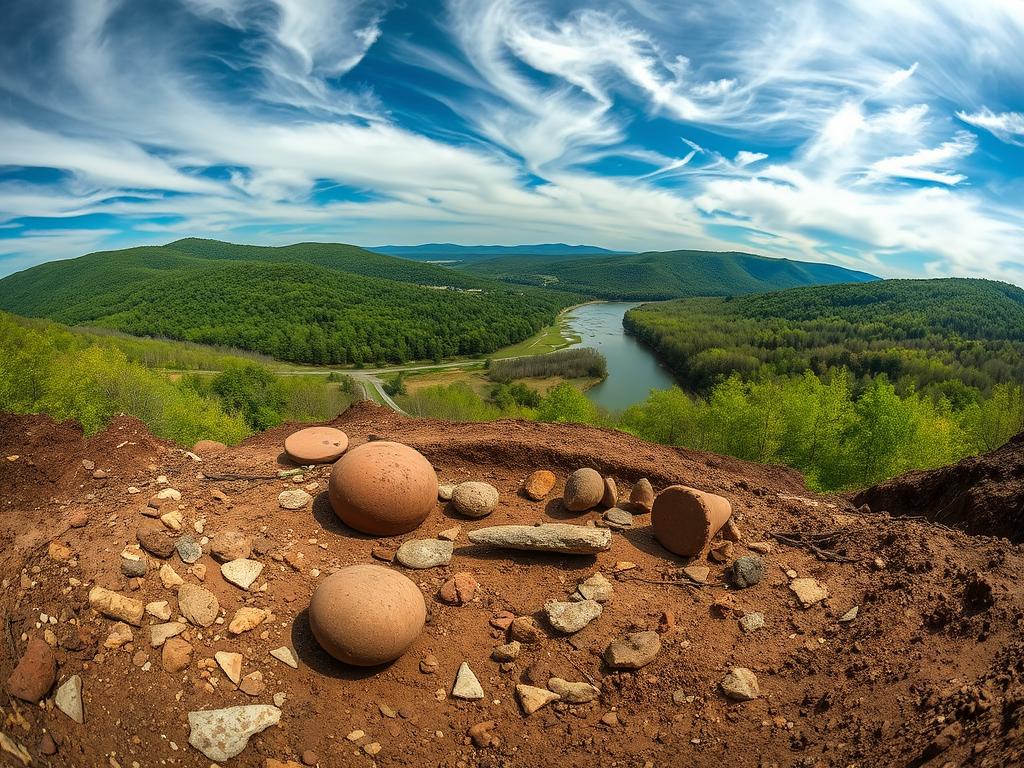
Fieldwork along the Roanoke River reveals how river corridors guided human choices across millennia; terraces and camps tell a story of repeated occupation and strategic location selection.
Repeated occupations over millennia
River terraces preserve campsites used seasonally or yearly for roughly 5,000 years, with key occupations dated about 10,000–13,000 years ago. Stone tool flakes, hearth charcoal, and refitting debris form a robust chain of evidence that these sites were revisited as resources fluctuated.
Data and methods
Excavations by teams from NC State, the Smithsonian, and National Geographic combined radiocarbon dating of charcoal with sediment cores and particle-size analyses. This methodological triangulation lets archaeologists link human layers to episodes of terrace formation or incision.
River dynamics and risk
The pattern shows how groups optimized mobility and resource use; transported lithics indicate regional networks. Comparative work in other valleys clarifies when local river behavior drove site choice versus wider regional shifts.
- Practical takeaway: Where terrace evidence shows instability, development should respect geomorphic warnings; stable surfaces merit conservation and cultural protection.
Prehistoric anthropology archaeology geography impact climate sustainability
Integrating site finds and landscape signals reveals how people adjusted subsistence and settlement when conditions shifted.
Integrating evidence: Combine artifact and feature-level data with geomorphic maps and proxies (charcoal, particle-size, geochemistry) to reconstruct coupled human–environment systems over long years.
Modeling adaptation: Parameterize settlement patterns and subsistence choices using past variability. Sensitivity tests show small hydrologic or temperature changes can cascade through resource networks and occupations.
Population dynamics and decision-making: Demographic pulses align with stable landscapes; contractions follow channel migration or drought. Comparative, journal anthropological reviews synthesize convergent ways societies reorganize under stress.
| Evidence type | Signal | Management cue |
|---|---|---|
| Site artifacts & hearths | Occupation intensity, subsistence shifts | Protect cultural sites; integrate into zoning |
| Geomorphology (terraces, floodplains) | Surface stability, channel migration | Map buffers; avoid high-risk development |
| Environmental proxies | Fire, drought, temperature trends | Trigger early-warning and scenario planning |

Policy relevance: Align hazard mapping with community rights and land stewardship. Practical tools —multi-criteria analysis and early indicators—translate past knowledge into equitable land-use decisions today.

Conclusion
Deep records from oceans and rocks show repeated environmental turns that shape living systems and human choices. From Precambrian oxygenation through Phanerozoic extinctions and Quaternary ice age cycles, the long view shows that change is recurrent and often abrupt.
The rapid swings 15,000–11,500 years ago remind planners that systems can reorganize within decades; those years ago are a cautionary baseline for today’s accelerated forcing.
Archaeologists and earth scientists together link settlement, grain-size signals, and river behavior to reveal how populations use land and adapt location choices.
Policy must protect adaptive capacity: flexible land use, iterative monitoring, and cultural refugia. Cross-disciplinary groups produce better hazard maps and more equitable outcomes for communities across years to come.

Key Takeaways
- Deep-time records provide a baseline for understanding long-run system behavior.
- Oxygenation events and tectonics reshaped carbon and nutrient cycles.
- Human decisions are recorded in artifacts that bridge environment and policy.
- Interdisciplinary methods (stratigraphy, geochemistry, settlement studies) strengthen inference.
- Past variability offers practical lessons for modern resource and risk planning.